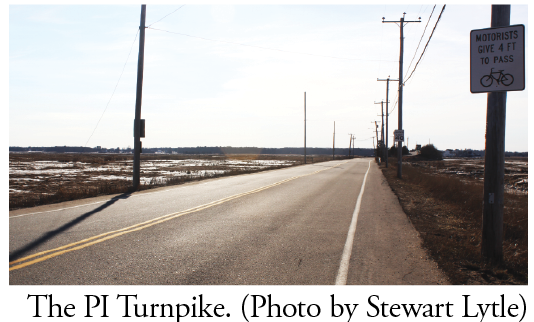
PLUM ISLAND – The Plum Island Turnpike, which connects the barrier island with the main land, will have to be raised three feet in most places to keep it from being inundated with water from the rising Merrimack River and the Atlantic Ocean.
But improvements to the roadway probably won’t happen for decades when the predictions are that by 2050 high tides on the river could be almost seven and a half feet, which will put the roadway under water.
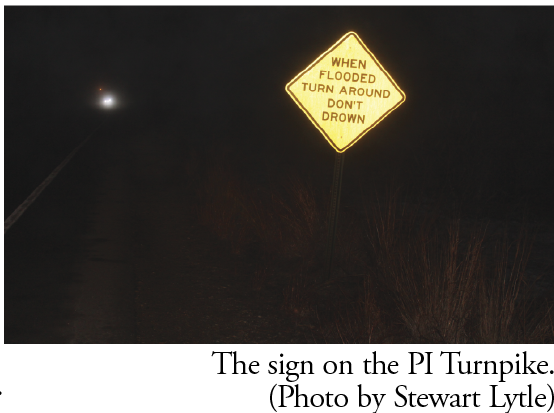
There are already signs along the turnpike that advise travelers and pedestrians to turn around during flooding so they won’t drown.
The U.S. Fish and Wildlife Service (FWS) delivered its latest update on planning for the turnpike to a full house of Plum Island area residents last week. It was the first presentation on the turnpike’s future since last May because the research and planning by the federal government stopped during the previous government shutdown.
The FWS’s Eric Doremus explained that the roadway today is not only subject to being under water during King Tides, but needs to be made safter than it is now to accommodate pedestrians, bicyclists and cars. He offered several scenarios that involved adding a shared path separated from the travel lanes on the river side by a barrier of plantings.
He also outlined several measures that the federal government could not do. It cannot build a wall against the rising tides like the Netherlands did. It cannot elevate the road to 13 feet and higher, which could happen during 100-year storms. Raising the road that high would be cost prohibitive and could harm the Salt Marsh.
Building an elevated road from Ocean Avenue to the bridge would also block access to local homeowners and businesses, such as Bob’s Lobster and the Parker River Wildlife Refuge.
The FWS does not have cost estimates for its multiple scenarios. The final report is expected in late summer, Doremus said.
The bridge is owned by the Department of Transportation and cannot be changed. For that reason, it is expected to allow bicyclists to enter the west-bound lanes on leaving the bridge.
Several options are being considered for the intersection with Sunset Drive. It could have a four-way stop, which might back up traffic entering and leaving the island. The scenario that seemed the most likely was to build a “mini-rotary,” raised to 10 feet, to funnel the traffic.
Sunset Drive would be raised to the gatehouse. And a sidewalk would be added in front of the businesses as cars enter the island.
Doremus said the planning and in the future the permitting process would be very complicated, involving multiple local, state and federal agencies. He predicted that it would ultimately be a model for other regional environment projects.
It is possible that the federal government can do little to nothing to improve the turnpike. In 1970, Congress passed a law restricting changes to wetlands, including the Salt Marsh. “We are afraid it might be a show stopper,” Doremus said.
But a provision in the law allows for changes that protect the public. “It is a grey area,” he said. And will need legal review. ♦